“David Attenborough's gobsmacking, awe-inspiring return” is how The Guardian described his 2022 BBC series, “The Green Planet”, in which the strange and wonderful world of plants was revealed, thanks to drone technology.
The 4-part series introduced millions of viewers to breathtaking scenes never before witnessed, offering a level of engagement hard to recreate through traditional means of communication.
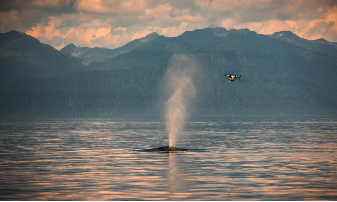 Speaking of breathtaking, the nonprofit Ocean Alliance, (founded by Roger Payne, a scientist credited with documenting that whales can sing), provided major funding for “Snotbot”, a modified drone that flies through a whale’s spout, or blow, collecting biological data on genetics/DNA, hormones and microbiomes.
But in the early days of this technology, using drones for conservation purposes was controversial. Many drones were deployed without any guidelines or regulations, resulting what’s now called “unethical drone footage”.
For example, a drone suddenly appearing amidst a herd of elephant was a major problem, since a drone sounds like a bee. In another example, in 2014, a low-flying drone caused a herd of Big Horn sheep to scatter, separating lambs from their mothers.
Onward and upward
The storytelling arising from these collaborations is what I call the “glue” that connects supporters with the causes they care about.
A boon for conservation and land trusts
Here in Canada, local, provincial and national land trusts and conservancies are responsible for monitoring and collecting data about the lands they steward. Supporters donate land to these organizations with the assumption the properties will be protected in perpetuity.
However, several of these properties are in remote or hard to reach locations. Most land trusts rely heavily on volunteers and operate on slim budgets.
For those who can acquire them, deploying drones enable these organizations to observe habitat and wildlife with minimal disturbances, improving documentation and reducing travel to remote properties.
In closing, I’ll end with a poem created by Open AI’s “ChatGPT”:
Autonomous flight above canopy lines,
Drones chart the data in spatial designs.
Thermal and visual, multispectral eyes—
They quantify life where the biome lies.
Tracking megafauna across the terrain,
Monitoring herds through savannah and plain.
In coastal shallows and pelagic zones,
They follow migrations in calibrated drones.
No need for intrusion, no stress to the pack—
Just remote sensing and annotated track.
From coral bleaching to poaching signs,
Each signal parsed in telemetry lines.
Algorithmic scans from a satellite’s peer,
Yield metrics for science, precise and clear.
Where once we guessed, now models grow—
Built from the circuits that silently flow.
 Natasha van Bentum is a longtime outreach and legacy advisor for the nonprofit sector. Over the years, she has been instrumental in promoting the creation of green legacy programs both in Canada and worldwide. This has resulted in millions of dollars being put to work to address the vital issues of our times and help create a greener and healthier future for future generations. She can be contacted at vanbentum@gmail.com.